Trails
Get outside and on the trails! Waltham and its neighboring communities offer numerous well-marked and maintained trails through a variety of beautiful natural landscapes.
The WLT has produced this series of trail maps and is proud to offer them as a free resource.
Check out the trail counter page to learn about our trail usage program.
Click maps to download or print!
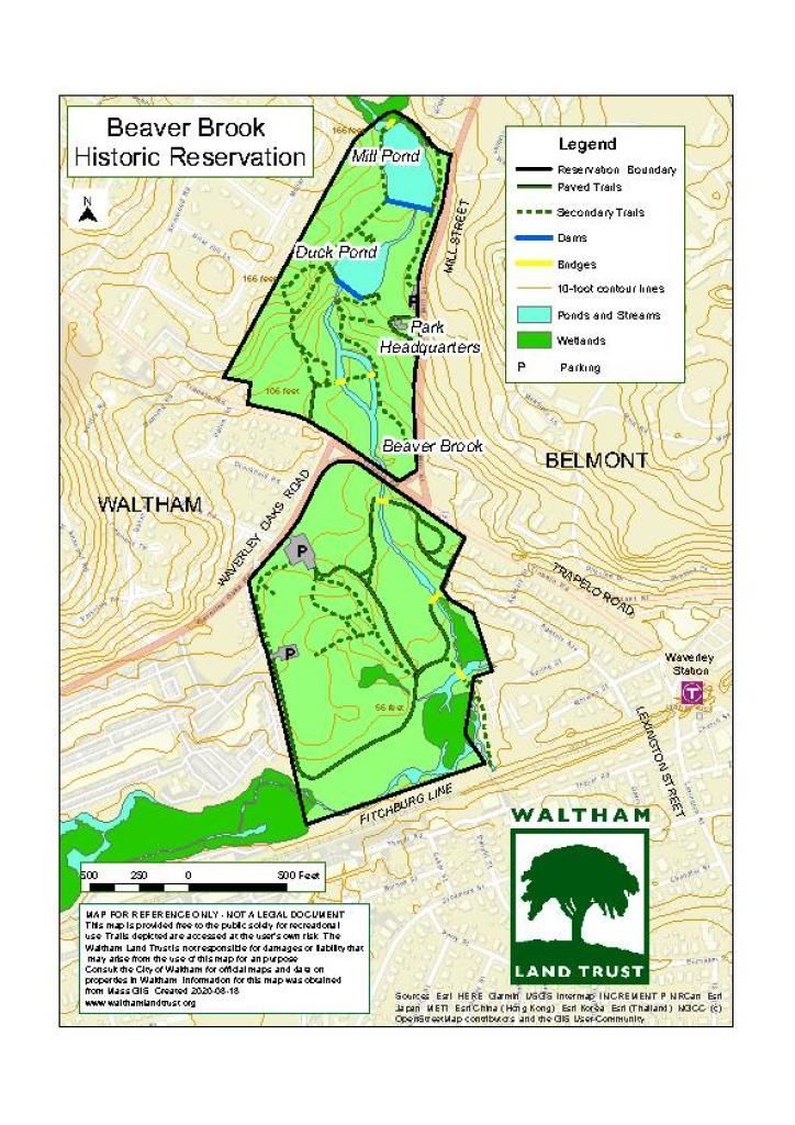
Beaver Brook Historic Reservation
Beaver Brook North Reservation
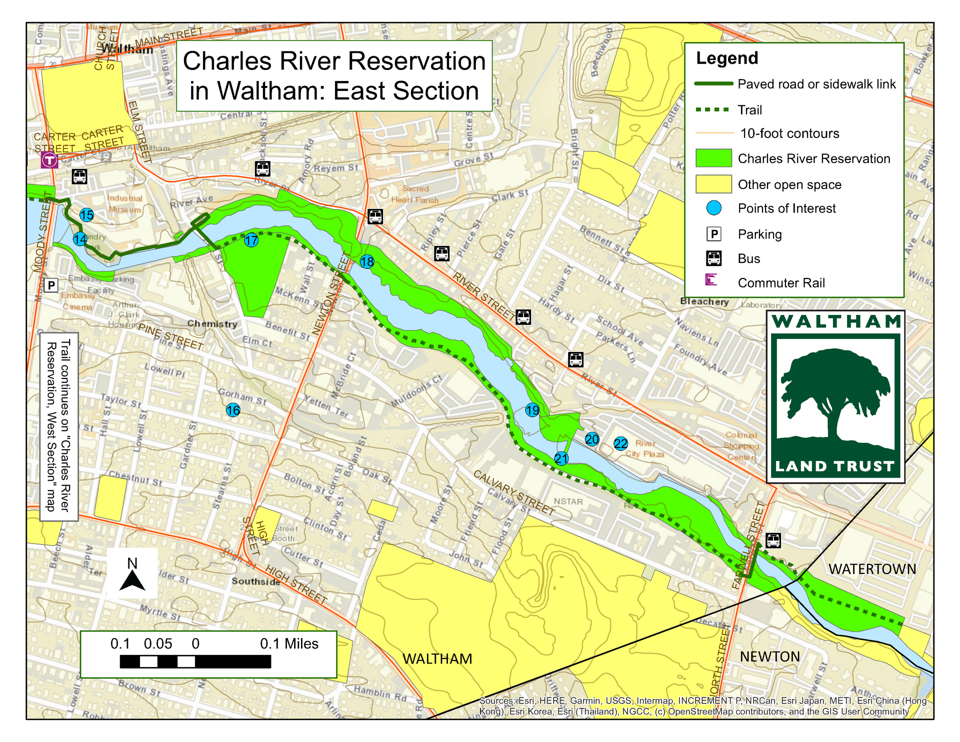
Charles River Reservation East
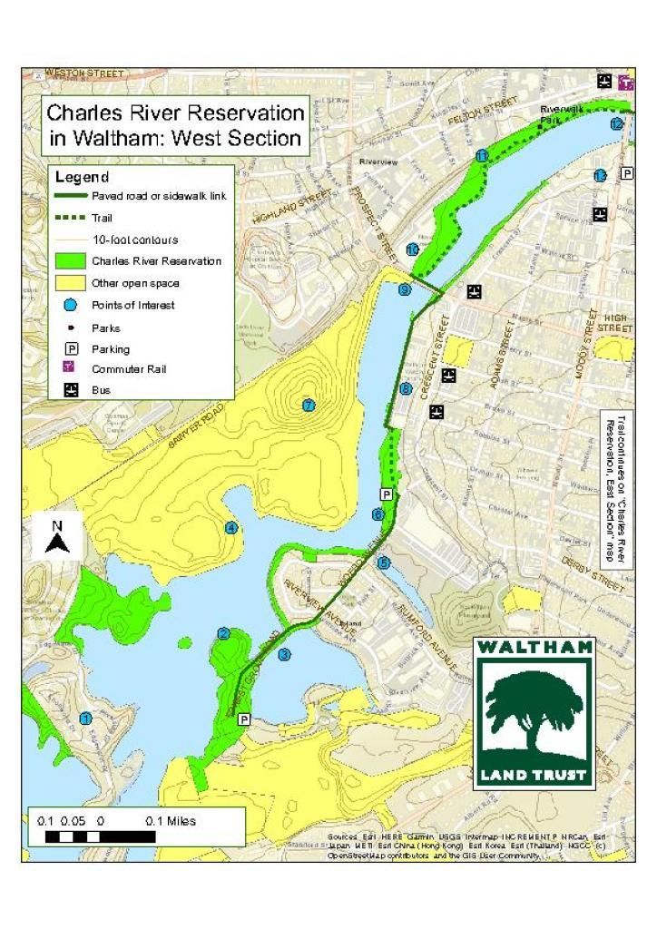
Charles River Reservation West
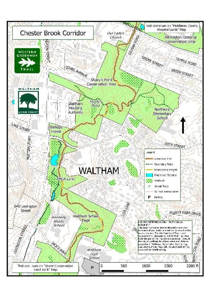
Chesterbrook Corridor
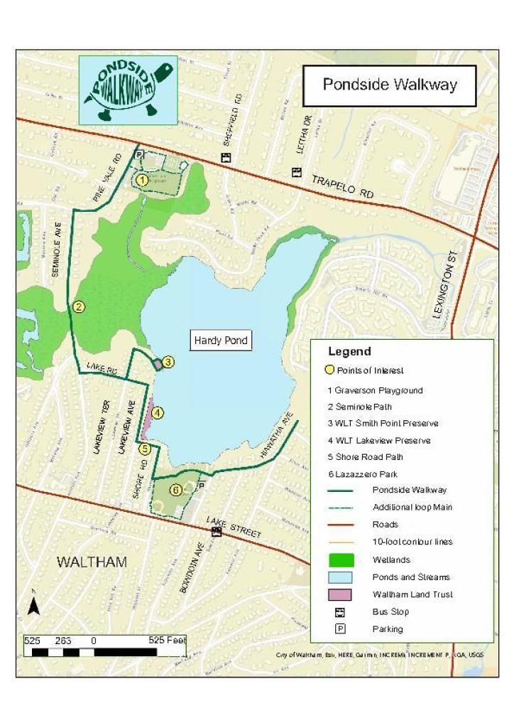
GOS Hardy Pond Pondside Walkway
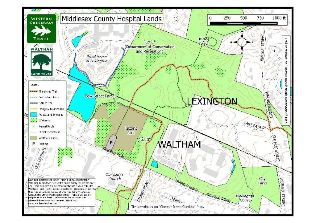
Middlesex County Hospital
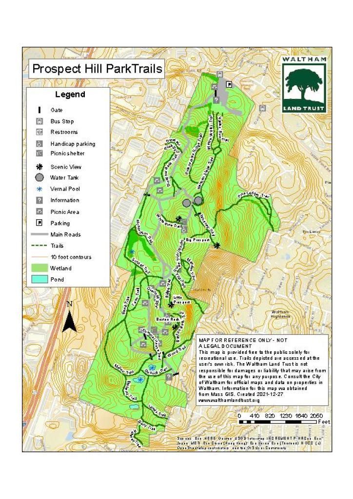
Prospect Hill Park Trails
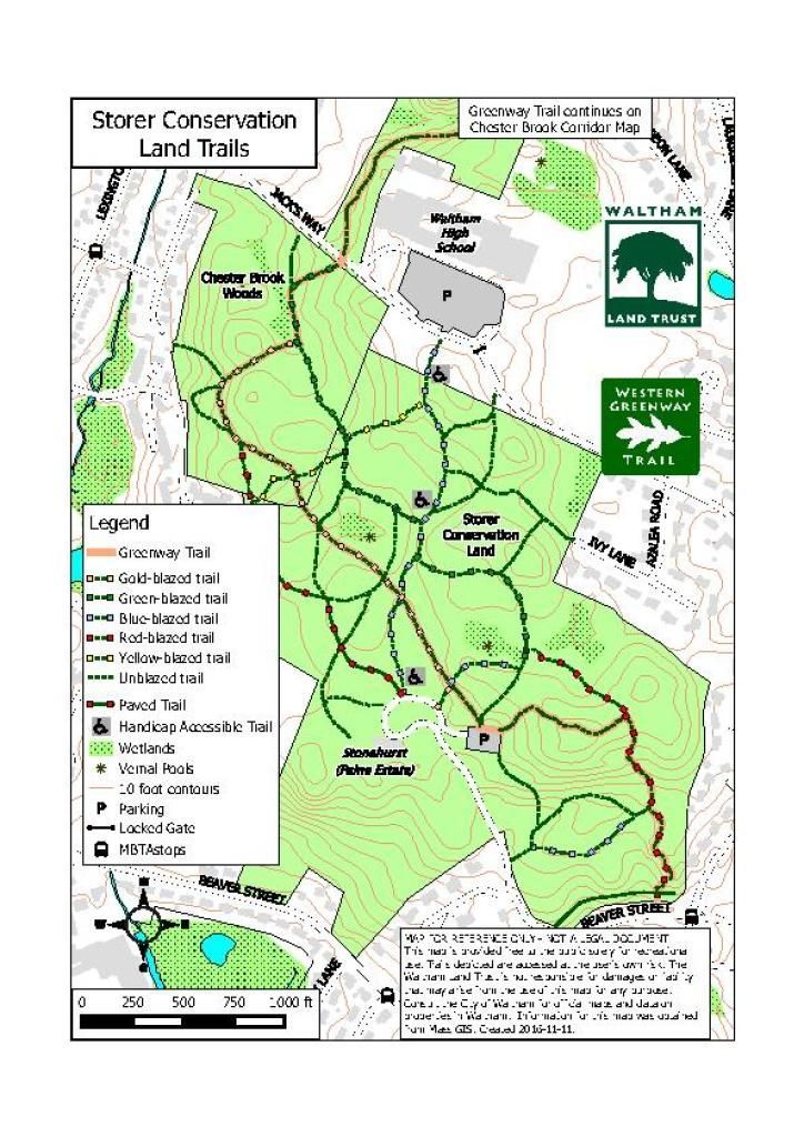
Storer Conservation Trails
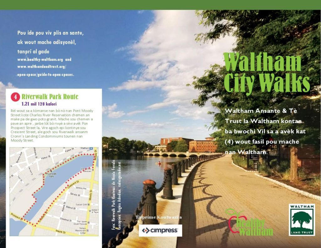
Waltham City Walks (Creole)
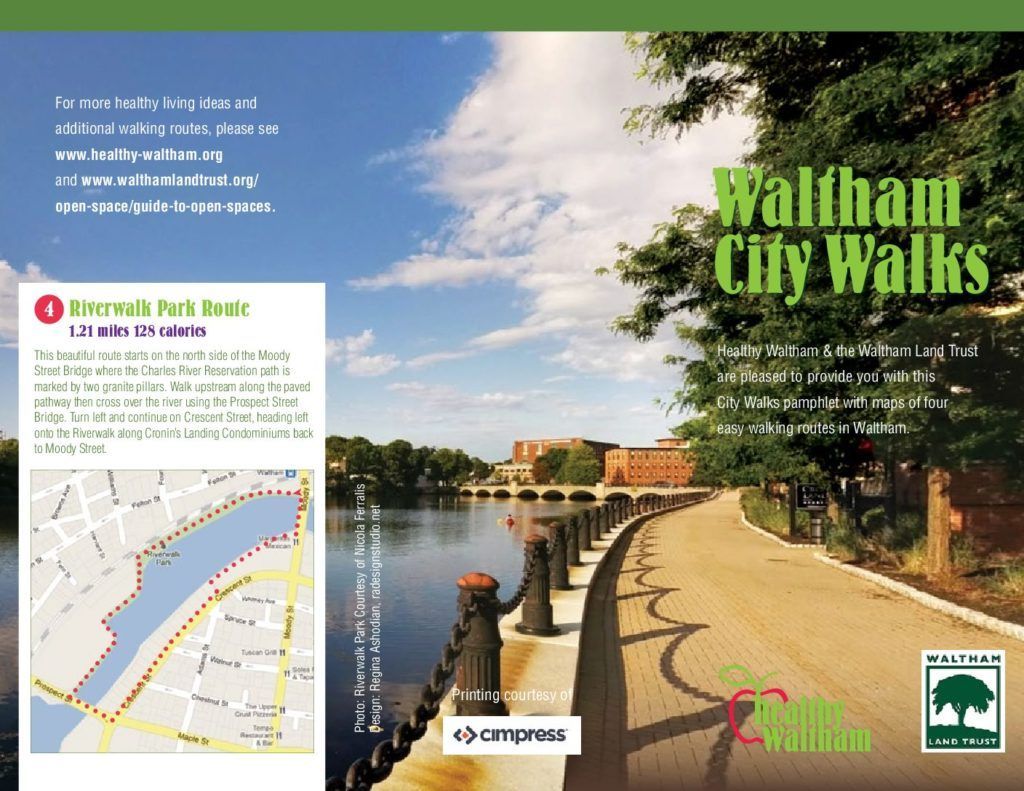
Waltham City Walks (English)
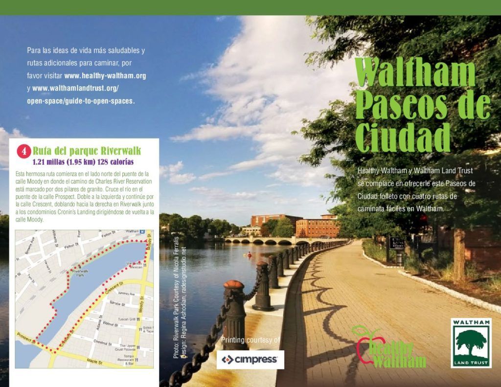
Waltham City Walks (Spanish)
The Western Greenway
The
Western Greenway is a 12 mile loop of open space in Waltham, Belmont and Lexington. The map below is an overview, not a trail map.
Click on the map to download or print!
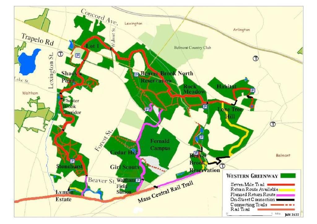
Western Greenway 2023
Disclaimer: By using our website, data or maps, you affirm your acceptance of the following terms and conditions. The Waltham Land Trust (WLT) disclaims responsibility for damages or liability that may arise from the use of our maps. Maps and information are provided by WLT as a public service. All information is provided without warranty of any kind. Information is derived from many sources and due to reasons outside of our control, may or may not be correct, complete or current. It is the responsibility of the user to confirm the data, which may be totally wrong. Neither the City of Waltham, DCR, GIS, WLT nor anyone else warrants the accuracy of the information, data or maps.